
Collierville ZIP Code Directory Coverage
Official USPS material documents two postal codes paired with Collierville. The primary geographic delivery area uses 38017. The separate 38027 designation is used for Post Office boxes and some mailing addresses, and USPS FAST lists it under Collierville 38017. Neither code is a neighborhood boundary, a tax district, a voting precinct, or proof that an address is inside the incorporated Town. Use the complete address before drawing a conclusion from a ZIP code.
| ZIP | Documented coverage | Post office | Postal note |
|---|---|---|---|
| 38017 | Primary geographic Collierville delivery area; Town Hall, library, Post Office, and many street addresses use it | Collierville Post Office, 131 S Center St, Collierville, TN 38017-9998 | Confirm each address with USPS; the ZIP can cross the municipal line |
| 38027 | Collierville postal designation for Post Office boxes and some mailing addresses | Collierville postal operation and Post Office box service | Do not treat it as a second Town neighborhood; exact box assignment was not separately published |
The USPS FAST labeling list states, “38017, 38027 - COLLIERVILLE TN 38017.” That pairing is strong postal evidence, not a street-by-street boundary map. Nearby eastern Shelby County postal areas belong to the wider region, but they are not listed here as ZIP codes serving Collierville without an address-specific USPS result.
Collierville Postal ZIP Check
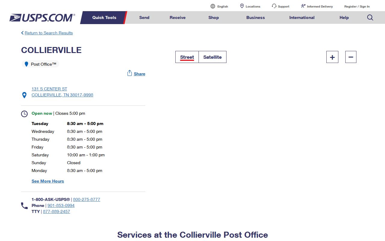
The USPS Collierville Post Office page is the source of this image. It identifies the Post Office at 131 S Center Street and shows its 38017-9998 postal designation. It is a useful official contact and location record, but it is not an address-boundary database. For a live street result, use the official USPS ZIP Code Lookup with the full address rather than relying on a mailing-city label.
A ZIP+4 is more precise than the five-digit ZIP. USPS may use it for a delivery segment, an apartment grouping, one side of a street, or a Post Office box range. Keep that postal result separate from a parcel's situs address and from the owner's mailing address.
Note: The Post Office page identifies a postal location, while a live address lookup supplies the current delivery result for one specific street address.
Search a Collierville ZIP Carefully
A ZIP code narrows an address search; it does not produce a public roster of everyone in that area. First validate delivery, then use the record system that accepts the type of search needed. The Shelby Register deed search permits ZIP as an optional address field, although it warns that ZIP is not on every document. GoVoteTN's Search By Address accepts street address and ZIP. The other state voter lookup requires county, first and last name, birth month, and birth year instead of a ZIP search.
- Confirm the full address through the official USPS ZIP Code Lookup and retain the five-digit ZIP or ZIP+4 result.
- Use the validated address in the Register GIS or Assessor route to identify the parcel, situs, tax map, and owner record.
- Search the Register instrument index with its optional address and ZIP controls, then compare the deed's parties, date, and legal description with the parcel.
- Use GoVoteTN only for its documented address route, or use the state voter lookup when the required name and birth fields are known. Contact the Election Commission for an official file request.
When the ZIP result has narrowed the work to a named street, use the Collierville street directory for the address-by-address record trail. Parcel, deed, and voter records each use different address fields, so do not collapse them into one claimed resident list.
Collierville ZIP Search Fields
The Register of Deeds search is the documented local record system with a ZIP field. Its address form recommends omitting direction and street type for a better search, such as MAIN rather than N MAIN ST. ZIP is optional, and the Register cautions that City, ZIP, and subdivision details do not appear on all recorded documents. The GIS page uses street number and name, owner, parcel ID, and tax map as its core search modes, even where ZIP appears in displayed location context.
| Official search | Field or route | Documented use |
|---|---|---|
| Register deed search | Address and ZIP | Both are text fields; ZIP is optional and may be absent from a document. |
| Register deed search | Subdivision, parcel, and lot | Additional text fields that can bridge an address that is missing from an instrument. |
| Register GIS | Street number, street name, owner, parcel, tax map | Use these modes to reach the parcel record; a ZIP-only GIS filter was not documented. |
| GoVoteTN | Street address and ZIP | Documented Search By Address route. |
| Tennessee voter lookup | County, first name, last name, birth month, birth year | All five fields are required; it is not a ZIP search. |
The Shelby Register deed index is the source of this image. Its controls show that ZIP is one optional element among party, parcel, lot, address, instrument, book-and-page, date, and document-type searches.
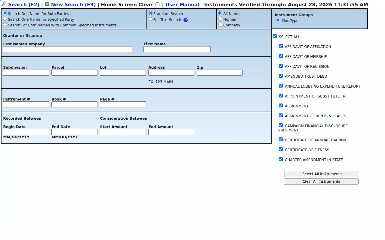
The screen can help locate a recorded instrument, not settle municipal jurisdiction or present residence. A deed can carry an old address or legal description, so compare it with the GIS parcel and the record date.
Collierville ZIPs and Town Limits
Postal delivery and Town jurisdiction diverge in Collierville. The Town's annexation materials describe an Urban Growth Boundary and a Collierville Reserve Area, where unincorporated land remains eligible for annexation. The Town lists annexations in 2012, 2016, 2017, 2019, 2020, and 2022. A postal city can therefore predate a Town service relationship. Building and Code inspection services begin on an annexation's effective date, and earlier permit evidence may rest with a different county or Town process.
Use the Town's map gallery with the assessor and Register GIS to test jurisdiction. Annexation History, zoning, subdivision, historic-resource, and land-use maps answer a different question than USPS delivery. A Collierville ZIP code alone is not proof of the current town line, property-tax treatment, or the custodian for a historic permit.
Postal geography. A Collierville mailing city and ZIP can reach the Town, reserve area, or adjacent delivery geography. Confirm the parcel jurisdiction before seeking Town-held records.
Collierville ZIP Address Terms
Several address labels appear in the same search but mean different things. The situs address is the property's physical location and is the key for an assessor, GIS, map, or permit search. The owner or mailing address is used for tax correspondence and may be outside Collierville, outside Tennessee, or associated with a trust, agent, or entity. A legal description uses lots, blocks, subdivisions, plats, metes and bounds, or parcel identifiers. It stays useful when a street name or number changes.
- ZIP and ZIP+4
- A ZIP is a postal routing code. ZIP+4 adds a delivery segment or grouping and is more specific than the five-digit code.
- Post Office box ZIP
- A postal code used with box service or mailing addresses; it does not by itself describe a geographic Town neighborhood.
- Carrier route
- A postal delivery grouping. It is not a municipality, voting precinct, census block, or public household roster.
- Situs address
- The physical property location used in assessor and GIS records, distinct from an owner mailing address.
These distinctions prevent a common error: treating an owner mailing address as proof that the owner lives at the parcel. The property card and deed may answer an ownership question while USPS answers a deliverability question.
Collierville ZIP History Before ZIPs
Older Collierville addresses predate modern ZIP codes. For a historical household or building, use the street and number with the legal description, plat, or parcel rather than forcing a modern postal code into an old record. Memphis Public Libraries documents city-directory holdings from 1849 to 1994 and suburban-directory holdings from 1964 to 1994. Selected cataloged suburban years, including 1971, 1972, 1975, 1989, and 1991, explicitly include Collierville.
Sanborn material located for 1892, 1897, 1902, 1907, and 1913 can show older streets, building footprints, and public or business structures. Pair a map with a deed, directory, or plat. No official source located a fixed Collierville street-renumbering year, so compare street labels, intersections, subdivision or lot information, and current GIS instead of assuming an old number has a direct modern match.
Note: A ZIP-free historic record can still be matched through its street, nearby intersections, subdivision, or legal description when the modern address is uncertain.
Collierville ZIP Results Need Care
Official systems have different update scopes. The Register deed screen reported instruments verified through April 20, 2026, while Register GIS warns that its property map reflects the April 2019 certified tax roll and is not an exact survey or legal ownership boundary. Those notices are not contradictory. They describe different records with different update cycles and purposes. Date a search result and retain the parcel ID, instrument number, or other record identifier that supports it.
A ZIP-wide conclusion should end where the records end. USPS validates postal delivery. The assessor and GIS support parcel context. The Election Commission can address an official voter-file request under its rules, but a public voter lookup is individual and disambiguated, not a block roster. If the custodian is unclear, make a focused request under the Tennessee Public Records Act and ask for the current fee or production estimate.